
The Northern Beltway Trail Now Has a Three-Phase Map From Decatur to Losee
Related Stories
Free Glow Bike Ride at Craig Ranch
NLV School Beacons and Free Outdoor Gyms
The dirt is officially moving. North Las Vegas broke ground on Wednesday, September 23 on the first 2.7 miles of new I-215 Northern Beltway Trail, and the city has now laid out two more phases that carry the path another 3.05 miles east to Losee Road. Add it up and you get roughly 5.75 miles of new lit, landscaped, signed trail along the north side of the valley, built in three pieces.
We covered the original announcement in North Las Vegas Breaks Ground on a 2.7-Mile I-215 Beltway Trail Extension. This piece skips the ceremony and goes straight to the map: which phase covers which streets, how far along each one is, and what the timeline actually looks like if you live anywhere between Decatur and Losee.
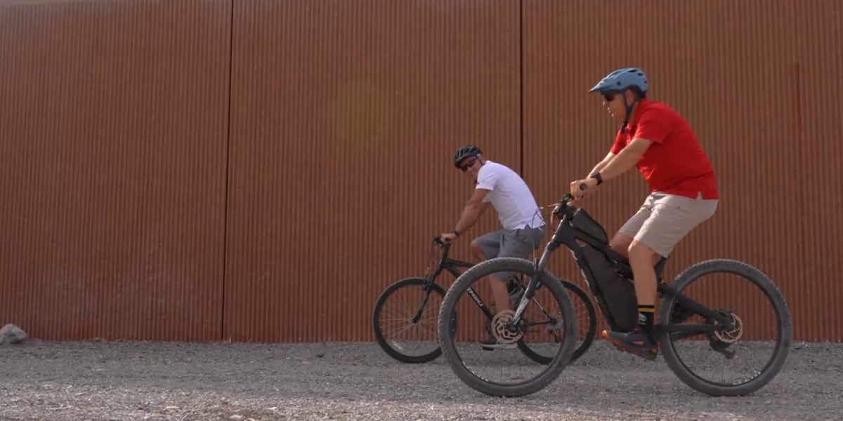
What Happened: The Three Phases, Street by Street
Here is the simplest way to think about this project. It is one trail, running parallel to the I-215 Northern Beltway, broken into three construction pieces that go from west to east. Each piece has its own start point, end point, and status. FOX5 Vegas reported the details after the September 23 groundbreaking, and its earlier September 16 report filled in how far along the later pieces are.
Phase 1: North Decatur Boulevard to Clayton Street. This is the 2.7-mile piece that broke ground on September 23. It runs alongside the freeway, and the city expects it to be finished in late 2027. The build includes the paved path plus trail lighting, native landscaping, wayfinding markers, and interpretive signage. This is the only phase with a shovel in the ground today.
The middle phase: Clayton Street to North 5th Street. This is the new piece of the puzzle. It adds 1.8 miles and picks up right where Phase 1 ends at Clayton. FOX5's September 16 report called this segment Phase 1A and said its engineering designs were already 90 percent finished. The September 23 report simply called it the second phase. Same stretch of ground, two different labels, so do not let the naming throw you if you see both.
The final phase: North 5th Street to Losee Road. This last piece adds 1.25 miles and runs along the south side of the I-215 from North 5th Street to Losee Road. The September 16 report said it would begin design work later this year. The September 23 report called it the final phase. Again, one segment, two names depending on which report you read.
Put those three together and the trail grows by about 5.75 miles, from North Decatur Boulevard all the way east to Losee Road. The headline number most people saw was 2.7 miles. That is accurate for what broke ground. It is not the whole plan. The whole plan is more than twice as long.
If you want a quick cheat sheet to save on your phone, here it is. Decatur to Clayton: 2.7 miles, under construction, done late 2027. Clayton to North 5th: 1.8 miles, design about 90 percent done, no start date yet. North 5th to Losee: 1.25 miles, south side of the freeway, design starting later this year. That is the whole corridor in three lines.

Why It Matters to Las Vegas Residents
The phase map matters because it tells you when the trail reaches your part of town. If you live near Decatur or Clayton, you have a real target date: late 2027. If you live closer to North 5th Street or Losee Road, your segment is still on paper. The difference between those two situations is years, not months, and it is worth knowing which one you are in.
Think about how a trail actually gets used. A 2.7-mile piece that opens by itself is a good walk or a short bike ride. When the middle phase connects to it, the path stretches to about 4.5 miles. When the final phase connects, it is about 5.75 miles of continuous new trail. Each new link makes the pieces before it more useful, because people can go farther without leaving the path or crossing into traffic.
The middle phase is the one to watch. At 90 percent design, it is much further along than most people realize. Design is the slow, invisible part of any public project. It is where the city decides the exact route, where the path crosses streets, where lights go, and how people get on and off the trail. A project that is 90 percent designed is close to being ready for the next steps, although no construction start date has been announced for it yet.
For families on the north side, this is about safe routes. A separated, lit path along the freeway corridor gives kids and parents a way to walk or ride that does not share pavement with cars. That is a big deal in a part of the valley where a lot of streets are wide and fast. For runners and dog walkers, lighting is what makes an evening outing realistic during the hot months, when early mornings and late evenings are the only comfortable times to be outside.
There is an everyday errand angle too. The north valley is spread out, and a lot of short trips happen by car simply because there is no comfortable way to walk or bike them. A continuous east and west path along the beltway gives people a real option for trips of a mile or two. It will not replace anyone's commute to the Strip. It can replace a trip to a friend's house, a ride to a nearby park, or a walk with the dog that does not involve dodging traffic on a six-lane road.
Renters and owners get the same benefit here. A public trail does not ask what is on your lease. If you live near the corridor, the path is yours the day your segment opens.
Background and History
North Las Vegas is not starting from zero. According to FOX5's September 16 report, the city already has a network of more than 70 miles of public paths. The new beltway segments add to that system instead of standing alone, which is part of why the phase sequence matters so much. A trail that ties into existing paths gets used. A trail that dead-ends at a freeway interchange does not.
The bigger goal is regional. When the full I-215 Northern Beltway Trail is built out, it is planned to run about 45 miles and connect North Las Vegas to Henderson. No one is going to ride that end to end anytime soon. But this is how a long regional trail really gets built: in funded segments, one city at a time, with each piece usable on its own the day it opens.
Splitting the Decatur to Losee stretch into three phases is a practical choice. Big public projects move through design, approvals, funding, and construction. Breaking a long corridor into smaller segments lets a city start building the piece that is ready while the next piece finishes design. That is exactly what is happening here. Phase 1 is under construction, the middle phase is nearly designed, and the final phase is about to start design. Three segments, three different stages, all moving at the same time.
The features matter as much as the miles. Lighting is what turns a daytime path into one people can use after work, which in a desert city is often the only comfortable time to be outside for much of the year. Wayfinding markers tell you where you are and how far you have gone. Native landscaping keeps water use down while still making the corridor feel finished. Interpretive signage adds a little context about the area. Building all of that into Phase 1 from the start, instead of adding it years later, is a sign the city wants people to actually use this trail.
One thing that has not been made public in the reporting is the price tag. Cost figures for each phase and the funding source were not included in either FOX5 report. Those details usually show up in city council agenda items and contract approvals, so watch for them there rather than relying on numbers floating around online.

What Happens Next: The Timeline to Losee Road
Here is the timeline as it stands today, based only on what has been reported. Phase 1, Decatur to Clayton, is under construction now and is expected to be finished in late 2027. The middle phase, Clayton to North 5th Street, has engineering designs about 90 percent done, with no construction start date announced yet. The final phase, North 5th Street to Losee Road, was set to begin design later in 2026. No completion dates have been announced for the middle or final phases.
So what should you expect over the next year? For Phase 1, the next 12 to 15 months are the build. Trail projects tend to happen in bursts. You will see grading and paving, then quieter stretches while crews install light pole foundations, run electrical conduit, plant landscaping, and put up signs. If you drive the beltway past Decatur and wonder why nothing seems to be happening for a few weeks, that is usually why.
For the middle phase, the next news to watch for is design completion and a construction contract. Once the design hits 100 percent, the project typically moves to bidding and council approval before crews can start. That is when you will learn a real start date and cost. For the final phase, design is the stage to pay attention to. Design is when the city decides where people can enter and exit the path, and where it crosses streets. That is the stage when public comment carries the most weight.
The honest read is this: the full Decatur to Losee stretch will not be done all at once. Phase 1 has a date. The other two phases have progress, but no finish line yet. Anyone who tells you the whole 5.75 miles will be done by a specific date is guessing.
If you live right next to the Phase 1 work zone, plan for the normal friction of construction. Expect trucks, fencing, dust control, and the occasional detour for people who already walk near the freeway. None of that is unusual, and all of it ends. It is the trade you make for a finished, lit path instead of an empty strip of dirt next to the beltway.
Ryan's Take
What I like about this update is that it turns a vague promise into a map. For the last week, most people heard "2.7 miles" and pictured one short path. The real story is a 5.75-mile corridor with three clear pieces, and the middle one is almost fully designed. That is a city running a pipeline, not a one-time project. Trail networks work when the segments keep coming, and they fail when there are long gaps between them. So far, North Las Vegas is doing it the right way.
From a real estate point of view, specifics are everything. Buyers do not get excited about "near a trail." They do get interested in "about a mile from a lit, landscaped path along the beltway, with the Decatur to Clayton segment scheduled for late 2027." If you own a home anywhere from Decatur to Losee, know which phase is closest to you and where it stands. The Decatur to Clayton segment is a real, dated amenity. The Clayton to North 5th segment is close behind it. The North 5th to Losee segment is a future plan. Describe each one accurately and you will sound like someone who knows the neighborhood, because you will. A trail will not move a comp by itself, but it gives buyers one more concrete reason to take the north side seriously.

What You Can Do
First, find your phase. Pull up a map, locate your home, and check where the nearest point on the I-215 is. If it is between Decatur and Clayton, you are in Phase 1 and your target date is late 2027. If it is between Clayton and North 5th Street, you are in the middle phase, which is nearly designed. If it is between North 5th Street and Losee Road, you are in the final phase, which is just entering design. That one step tells you more than any headline.
Next, if you live near the middle phase, keep an eye out for the construction contract. When a design reaches 100 percent, the project usually goes to bid and then to the city council for approval. That agenda item is where you will finally see a real start date and a real cost, instead of guesses from around the internet.
Then, if you live near the final phase, get involved during design. That is the window when the city decides access points and crossings. Watch the City of North Las Vegas city council agendas and the city's parks and recreation updates for the North 5th Street to Losee Road segment. If you want a connection point near your street, or you are worried about a specific crossing, speak up while the plan is still being drawn.
Finally, if you are thinking about selling in the next couple of years, write the details down now. Note the segment closest to you, the endpoints, the status, and the date if there is one. Buyers trust facts they can check. And in the meantime, get out and use the paths North Las Vegas already has. With more than 70 miles of public paths already in place, there is plenty to explore while the new segments come together.

Have questions about how this affects your home or neighborhood? Reach out to Ryan Rose or text/call 702-747-5921 anytime.
Sources
FOX5 Vegas: North Las Vegas breaks ground on 2.7-mile I-215 Northern Beltway Trail expansion
FOX5 Vegas: North Las Vegas to break ground on major I-215 trail expansion
Categories
- All Blogs (4796)
- Absentee Owner (4)
- Affordability (3)
- ALIANTE (53)
- Anthem (33)
- Ascension (50)
- Assumable Loan (1)
- Astra (50)
- BLACK MOUNTAIN (55)
- Buyers (22)
- Cadence (17)
- Calico Ridge (50)
- Canyon Fairways (50)
- CANYONS OF SUMMERLIN (55)
- CENTENNIAL HILLS (81)
- Comparisons (46)
- CROSSINGS IN SUMMERLIN (55)
- DESERT SHORES (47)
- Divorce (3)
- Downsizing (13)
- EAGLE HILLS (55)
- Empty Nester (1)
- Enterprise (1)
- EXPIRED LISTINGS (134)
- First Time Homebuyer (4)
- Green Valley (139)
- Henderson (82)
- HORIZONS EDGE (50)
- Housing Market Trends (100)
- Informative (112)
- Inspirada (58)
- Lake Las Vegas (2)
- Lakes Las Vegas (3)
- Las Vegas Real Estate (182)
- Local News (591)
- Luxury (1)
- MacDonald Highlands (88)
- MacDonald Ranch (100)
- Madeira Canyon (93)
- MESQUITE NV (103)
- MOUNTAIN TRAILS (50)
- Mountains Edge (79)
- Naked City (35)
- New Construction (131)
- North Las Vegas (24)
- Northgate (23)
- PALISADES SUMMERLIN (50)
- Probate (28)
- Providence (2)
- Quail Ridge (35)
- QUEENSRIDGE (56)
- Red Rock (1)
- RED ROCK COUNTRY CLUB (60)
- Relocating to Summerlin (207)
- Relocation (45)
- Retired (1)
- Retirement (1)
- Reverence (15)
- RHODES RANCH (64)
- Ridgebrook (40)
- Sellers (255)
- Seven Hills (83)
- Silverado Ranch (1)
- Silverstone Ranch (39)
- SKYE CANYON (100)
- SKYE CANYONE (4)
- Southern Highlands (94)
- Southwest (19)
- SPANISH TRAILS (55)
- SPRING VALLEY (70)
- Summerlin (104)
- Sun City Summerlin (3)
- The Arbors (37)
- The Cliffs (50)
- THE HILLS (55)
- THE PASEOS (55)
- The Pueblos (27)
- THE PUEBLOS OF SUMMERLIN (42)
- THE RIDGES (65)
- THE VISTAS OF SUMMERLIN (50)
- The Willows (60)
- Thoughts on Home Tour (2)
- TOURNAMENT HILLS (50)
- Veterans (3)
- WHITNEY RANCH (55)
- Workers Advantage Program (100)
Recent Posts





GET MORE INFORMATION